Environment and Permafrost Geoscience
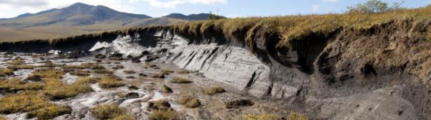
Environmental Geoscience examines Earth Sciences as it pertains to human activity and environmental science. Our environmental geoscience research focuses on permafrost - ground that remains below 0 ºC for two consecutive years. Permafrost is a geological manifestation of climate that affects and is affected by vegetation, water, landforms, and infrastructure. In the Northwest Territories, permafrost conditions vary from discontinuous permafrost in the south to continuous permafrost in the north. In the discontinuous zone, permafrost exists only where surface and ground characteristics combine to maintain ground temperatures below 0 ºC. Permafrost in the continuous zone is typically colder and underlies the entire landscape except under large bodies of water. Research topics are related to permafrost, climate change, geohazards, and infrastructure.