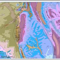
Geological Compilation of the Northwest Territories
Description
This project uses existing digital geological data to assemble a 1:250,000 scale map of NWT bedrock geology for inclusion in a Geographic Information System (G.I.S.). The ultimate goal is to provide a comprehensive bedrock map as a base upon which as much geological and other data as possible may be layered.
Justification
The NWT hosts several operating mines and is an important region of interest for several large and small scale exploration programs. These activities, as well as extensive land use planning exercises, have raised the profile of the bedrock geology in the NWT and highlighted the need for a robust pan-territorial compilation. This compilation will serve as a framework for interpreting other geoscience datasets, will support exploration efforts and resource management decisions, and will highlight gaps where new geoscience research is needed.
Approach
The bulk of the present compilation process is the development of a new synthesis of the NWT geology. This involves the inclusion of maps and other data at a boarder range of data densities than used in previous compilations. This compilation also embraces areas adjacent to the NWT, including offshore areas where well and seismic data are available. These are required to make the map and database seamless and internally and externally consistent.
Schedule
Work has focused on the western mainland NWT, the Arctic Islands, the east-central mainland (Slave Craton) and adjacent parts of Yukon Territory and Nunavut. Recently released, NWT Open File 2016-09 reflects the work so far on the western mainland NWT and Arctic Islands. The Slave Craton is currently being updated from the 2005 release. The Geological Survey of Canada’s compilation of the Churchill Geological Province has been adapted and included in the NWT compilation. Further compilation work is planned for the central mainland (Bear Geological Province). The compilation layers can be downloaded from the NTGS Data Hub.
Keywords
GIS, Compilation, Geology, Map, Rocks, Mackenzie, Richardson, Mountains, Slave, Craton, Poster, Database, Geodatabase


