Slave Province Surficial Materials and Permafrost Study
Slave Province Surficial Materials and Permafrost Study
 drill. Credit: Aurora Geoscience")
Description
The Slave Province is a geological formation that lies between Great Slave Lake and Coronation Gulf. The area contains some of the oldest known igneous and metamorphic rocks on Earth, and has a long history of mining. This project examined the surface sediment deposited during several past glaciations, as well as permafrost. Minerals of economic interest are found within the surface sediment and can be used to locate economic mineral deposits in the underlying bedrock. This project improved our understanding of glacial sediments, stimulated exploration for diamonds and metals in the Slave Province, and helped determine permafrost conditions to inform future infrastructure development.
 drill transported to the study area on the ice road. Credit: Aurora Geoscience.")
Location
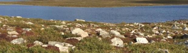
The study area (~150 km x 100 km), centred in the Lac de Gras Region of the Slave Geological Province, ~300 km northeast of Yellowknife.
 drill. Credit: Aurora Geoscience")
Justification
The Slave Province has excellent potential for new mineral deposits. Locating these deposits is hindered by complex glacial sediments that lay on top of the bedrock. A better understanding of these sediments is of economic interest. Permafrost can pose a major challenge to infrastructure development in the region. This study will produce a regional permafrost dataset. This permafrost study is unprecedented in size and depth and will establish the NWT as a world leader in permafrost studies.
 drill, winter 2015. Credit: Aurora Geoscience")
Approach
Standard and innovative methods were used to examine the mineral potential, glacial history, and permafrost conditions of the surficial sediment. A combination of reverse-circulation (RC) drilling and core drilling was used to collect sediment samples. Field mapping of surficial sediments and hand sampling were carried out. Permafrost temperatures were monitored using sensors installed in the ground.

Schedule
The first stage of this project began in 2014 and ran until the end of the fiscal year 2015/2016. The initial data were available in the spring of 2016, with more in-depth analyses released as Northwest Territories Geological Survey publications and scientific articles.

Partners and Support
This project has been made possible by generous support from the Canadian Northern Economic Development Agency's (CanNor) Strategic Investments in Northern Economic Development (SINED) program.
Project partners:
• Dominion Diamond Ekati Corp.
• Diavik Diamond Mines Inc.
• North Arrow Minerals Inc.
• Peregrine Diamonds Ltd.
• New Nadina Explorations Limited
• Arctic Star Exploration Corp.
• The Canadian Mining Industry Research Organization (CAMIRO)
Collaborators include:
• Martin Ross, University of Waterloo
• Brent Ward, Simon Fraser University
• Don Cummings, Carleton University
• Stephan Gruber, Carleton University
• Peter Winterburn, University of British Columbia
Keywords
Slave Geological Province, Permafrost, Quaternary Geology, Glacial Geology, Mineral Potential, Glacial Attrition, Glaciofluvial Corridors, Drift Prospection Sampling, Glacial Dispersal Train, Kimberlite Indicator Minerals, 3D Till Sampling, Strategic Investments in Northern Economic Development, SINED, Canadian Northern Economic Development Agency, CanNor